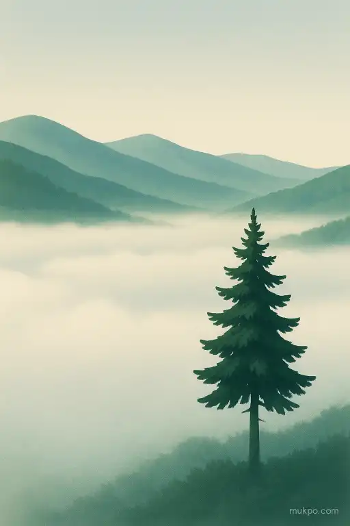
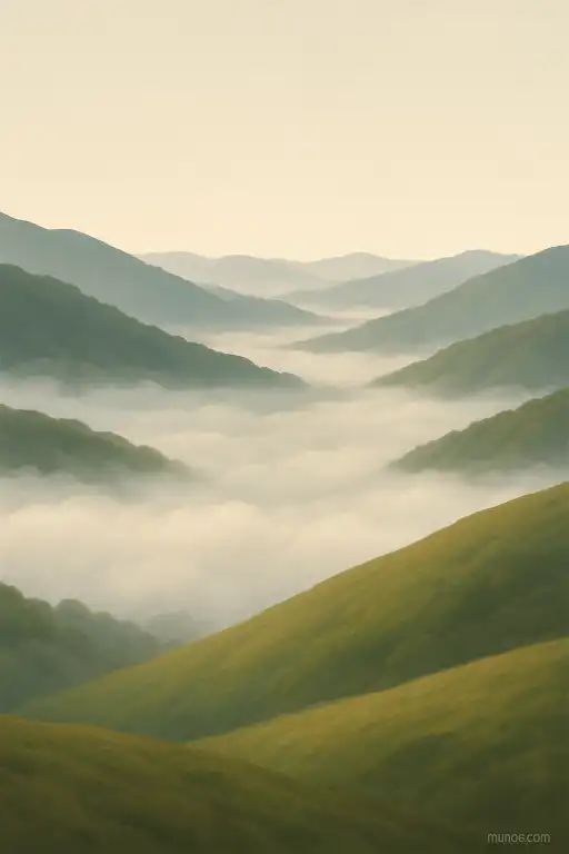
You’ve probably seen it on a drive where the road snakes uphill. The valley below looks filled with a flat, white layer, while the ridge line is sharp and sunny. This isn’t tied to one famous place. It shows up in California’s Central Valley, the Po Valley in Italy, and around Innsbruck in Austria. The basic reason is simple: on some nights the air near the ground in low spots becomes colder than the air above it, and moisture condenses into tiny droplets. That cold, heavy air tends to pool in the lowest terrain, so the fog stays down there while higher ground sits above the moist layer.
Cold air pools in the lowest terrain
After sunset, the ground loses heat quickly by radiating it to the sky. The air touching that cooling ground chills too. Cold air is denser than warm air, so it tends to slide downslope and collect in basins, valley bottoms, and hollows. This creates a “cold-air pool,” sometimes with a sharp temperature jump between the valley floor and the slopes. People often notice it as a sudden change when they drive downhill at night: it can be several degrees colder in the last few hundred meters.
Once that cold layer settles, it can act like a lid. Air above the valley can stay warmer and drier, especially on clear, calm nights. That vertical arrangement—cold below, warmer above—is a temperature inversion. It’s the opposite of the daytime pattern most people expect. And it matters because fog formation depends strongly on how close the air is to saturation.
Fog forms when the air hits its dew point
Valley air often contains moisture from rivers, damp soil, irrigated fields, or just yesterday’s rain. When that air cools, it reaches its dew point, meaning it can’t hold the same amount of water vapor. Water starts condensing onto tiny particles in the air. Those particles—dust, sea salt, smoke, and pollution—are the usual overlooked detail. Without enough of these “condensation nuclei,” fog can be thinner or patchier even if the humidity is high.
Once droplets form, the fog itself can help maintain the setup. Fog reduces how much the ground warms after sunrise by blocking some sunlight. That keeps the surface cooler, which keeps the lowest air cooler, which keeps the fog from evaporating quickly. Meanwhile, ridges may be above the fog top, getting full sun and mixing with drier air aloft.
Ridges stay clear because the air is different up there
Higher ground often sits in air that’s been mixed by the wider atmosphere. Wind speeds tend to be stronger on exposed ridges than on sheltered valley floors, and that wind disrupts the calm layering that fog needs. Even a light breeze can keep moisture from accumulating near the surface, or it can replace saturated air with drier air from elsewhere. That’s why a valley can be still and foggy while treetops on the ridge are moving.
There’s also a geometry problem. Valleys have more surface area close to the air that’s cooling and a smaller volume of air that has to be cooled to reach saturation. Ridges are the opposite: the air is freer to drain away and mix, and the ground isn’t “collecting” cold air the same way. So even if the humidity is similar, the ridge air may never cool quite enough to cross the dew point.
Topography can trap fog like a slow leak
Not all valleys behave the same. A broad valley with an open outlet can vent cold air and moisture more easily than a closed basin. A narrow valley with a shallow “sill” or constriction can hold the cold-air pool longer, because the dense air has to spill out like water over a low dam. That’s why fog can have a remarkably flat top and an abrupt edge near a pass or gap.
Local land use can tip the balance. Irrigated farmland, wetlands, and reservoirs increase near-surface moisture and make fog more likely on calm nights. Urban areas can do the opposite by staying warmer overnight, though they can also add particles that help condensation. The mix varies by region and season, so two nearby valleys can look completely different on the same morning.
Why it can switch fast from one morning to the next
Small changes in the weather decide whether the fog layer forms and whether it lasts. Clear skies and light winds favor strong nighttime cooling and stable inversions. A thin cloud deck can act like a blanket and reduce cooling, so the valley never reaches the dew point. A modest overnight wind can stir the air just enough to prevent the cold pool from settling, or it can push the fog into one branch of a valley and leave another clear.
Even the timing matters. If the air becomes saturated early in the night, fog has more hours to deepen and spread across the floor. If saturation happens right before dawn, the layer can be shallow and fragile, and it may burn off quickly where sunlight hits first—often on slopes and ridges—while the valley bottom stays shaded and holds onto the cold air a little longer.
Related reads
- Why some conversations make you forget time completely
- A café that brews espresso in cups stitched from old concert wristbands
- The beach where certain shells sing when the tide goes out
- The Cold War diplomat who ran an art forgery ring out of a consulate pouch
- Why an entire block unintentionally matched paint after a single storm
- The streetlight turned time capsule: decades of lost items stuck in its base