A name that kept showing up where nothing was
If you look at enough old maps, you start noticing something odd: the same “extra” island appears again and again, sitting out in the Atlantic as if it’s as solid as Ireland itself. On some charts it’s labeled Hy-Brasil and placed west of Ireland, not far from where sailors already had reason to fear fog, reefs, and bad weather. It turns up in medieval and early modern map traditions, even when different mapmakers disagreed about coastlines and distances. That repetition is the mechanism here. Once a feature gets copied from one respected map to the next, it can become “true” on paper long before anyone can confirm it at sea.
How it looked on maps, and why that matters
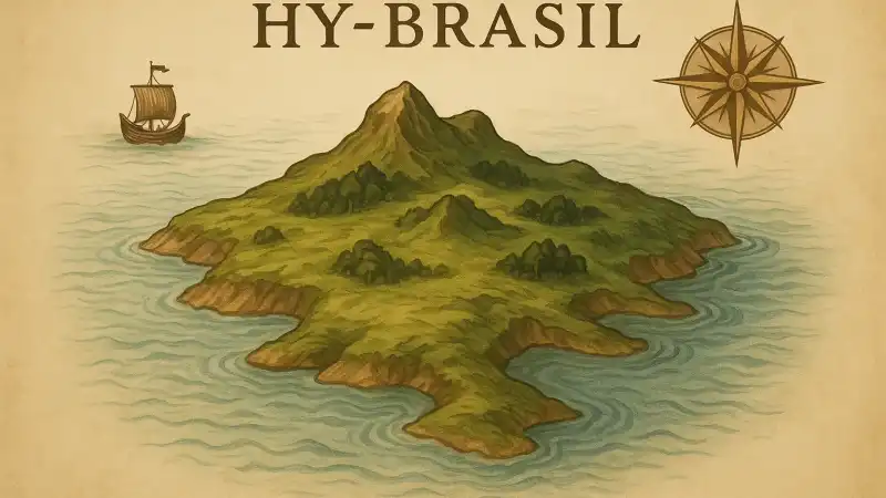
Hy-Brasil isn’t consistent. That’s part of why it’s so revealing. It’s often drawn as a near-perfect circle, sometimes split by a straight channel across the middle, like two halves with a thin strait between them. That little design choice is easy to overlook, but it tells you the island was being handled as a recognizable icon, not as a surveyed coastline. Mapmakers were signaling, “You’ve heard of this place,” the way a modern map might mark a famous landmark with a simplified symbol.
Placement mattered too. Putting the island west of Ireland made it feel plausible. Ships did sail those waters, but navigation was rough and positions were hard to fix precisely for much of this period. A feature could hover in the same general zone for decades while drifting a bit from map to map, because “west of Ireland” was a wide target when longitude was uncertain and reports traveled slowly.
The report-to-map pipeline in the medieval Atlantic
Most of the time, a cartographer wasn’t collecting fresh sightings. They were compiling. Information came from pilots’ notes, merchants’ stories, older charts, and written descriptions that mixed practical detail with rumor. In the North Atlantic, that pipeline was especially messy. Weather can hide land for days. Low islands can vanish behind haze. A distant bank of cloud can look like cliffs. If someone came back insisting they saw land where none is charted, that claim didn’t have to be perfectly reliable to become useful. It only had to be repeatable enough to copy.
There’s also a social angle people miss. A map was an argument for competence. Leaving out a “known” island could make a chart seem incomplete, even if the island was doubtful. Including it showed you were plugged into the accepted body of geographic knowledge. That pressure pushes phantom islands toward survival, not disappearance.
Why people kept thinking they found it
Once an island is on maps, the ocean starts generating confirmations. Sailors already expected something to be there, so ambiguous sights get interpreted in that direction. A dark line on the horizon can be land. A sudden patch of calm water can feel like a lee. Even sea life can mislead: large flocks of birds and drift patterns can suggest nearby land because they often do, just not always the land you think. In that setting, “we were near Hy-Brasil” becomes an easy explanation for a day of confusing navigation.
It also didn’t help that the Atlantic off Ireland is full of real features that don’t behave like tidy coastlines. There are banks, rocky outcrops, and changing conditions that can make the sea look different from one voyage to the next. So the absence of an island on a later trip didn’t necessarily cancel the earlier story. It just became “we missed it,” “fog hid it,” or “currents set us off course.”
What happened when mapping got less forgiving
Phantom islands tend to fade when navigation and surveying tighten up. As positions became more precise and sea routes more regular, the “somewhere out there” zone shrank. Features that couldn’t be re-found started to look less like geography and more like inherited clutter. Hy-Brasil lingered because it had a strong identity on the page, but eventually repeated non-detections mattered. A later chart that omits a famous island isn’t just making a correction. It’s also signaling a change in standards: confirmation begins to outrank tradition.
What’s left is a paper trail. A circle in the ocean that moved from chart to chart, kept alive by copying, expectation, and the very normal difficulty of seeing clearly at sea. The island’s most durable location was never the water west of Ireland. It was the space on a map where mapmakers were reluctant to erase what other mapmakers had already drawn.
Related reads
- The lighthouse that slowly sank into the dunes while its light kept burning
- Victorian hairwork the 19th-century craft of weaving mourning into jewelry
- The apartment building where each elevator responds only to a specific melody
- Why some leaves hold beads of dew while others stay dry
- Why pretending calm can sometimes actually soothe your panic
- Why compliments can feel uncomfortable to receive